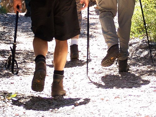
La Gomera is a beautiful small island, in a small space hosts many landscapes that impress and excite the traveler walking his rugged terrain composed of breathtaking gorges and palm groves of great beauty, crowned by thick forests of laurel. It is ideal for hiking, and make routes, well-planned space, will allow you to know La Gomera inch by inch.
The island has a network of well-marked trails accordance with the rules of the European Federation of Hiking (ERA): The great routes (GR) are marked with red and white markings, small routes (PR) are marked with yellow and white and local trails (SL), have a maximum of 10 km and are marked with green and white.
One of the classic routes Gomera is the way down the Roque de Agando to Playa de Santiago, with a duration of 3:30 hours and 12.5 km long. With difficulty rated as average, with a very steep at first and then a comfortable descent path paved rural track and end road with little traffic.
The route starts at the foot of Roque de Agando (1050 meters), considered the most emblematic natural monument of the island, part of the Garajanoy National Park and the Integral Nature Reserve Benchijigua, its peak reaches 1,250 meters. We circled behind the monument in memory of the victims of the 1984 fire, along the road and down the center through the beautiful Benchijigua ravine. In this first section, the vegetation is dominated by a relatively thick brambles and escobonal. In the lower part of the basin of the ravine, we find a string of villages that are a clear example of traditional architecture (small houses of thick stone walls and tiled roof).
You can make a first stop in the village of Benchijigua, one of the oldest settlements of La Gomera, home of emigrants from Louisiana during the Spanish rule in 1783. Located 600 meters from the Roque de Agando and about 12 km from Playa de Santiago. In this town where are almost no inhabitants residing permanently, the company Fred Olsen has restored some traditional-style houses, promoting rural tourism.
We continue down, accompanied by some eucalyptus thick trunks and some old orchards we find a beautiful waterfall, when the winter was rainy, called Arcón de Minaya.
After Arcón de Minaya, we find the small village Lo del Gato, with its clustered houses surrounded by plains and terraces where there are neighbors who carefully cultivate their gardens.
The trail follows the ravine towards Pastrana, a hamlet located amidst a beautiful palm grove about 260 m, which has a water mill over a hundred years old, in perfect condition that is still used for grinding gofio.
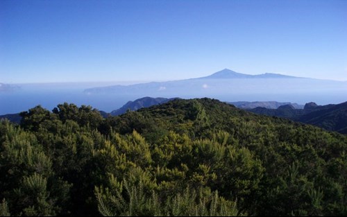
From Pastrana, the road becomes a narrow paved road. In the final section, we will reach Playa de Santiago, where banana plantations abound, we found the Hotel Jardin Tecina where we can see the island of Tenerife. It has a small town of whitewashed houses and a port which is usually the starting point for sailing and whale watching. Having reached the end of our walk, a swim at the beach of Santiago, next to the fishing port, will be the climax of our wonderful hike.